Viewing Imagery Footprints
Imagery footprints serve as an inventory layer for imagery acquisitions over time. Imagery footprints are visible at all zoom levels so you can quickly assess an area at high altitude to see if imagery is available. You can view imagery footprints for several time frames from the last year to the last 24 hours, or you can view footprints for specific years. To further filter imagery footprints, you can also specify one or more sensors.
Footprints are available for the online and archive imagery catalogs. Available sensors may vary by catalog.
-
Select Imagery. The Imagery panel opens.
-
On the Imagery panel toolbar, select Imagery Footprints
 . The Imagery Footprints menu opens.
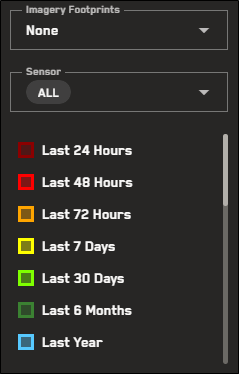
The Imagery Footprints menu.
-
From the drop-downs, select options to filter the imagery footprints that display in the viewport.
-
Sensor (Optional; Default: All) The sensor(s) you want to use (e.g., WorldView-2, GeoEye-1, all).
-
Imagery Footprints (Default: None) The time frame of the imagery acquisition date (e.g., last 24 hours, last 7 days, last year, none)
After you select the sensor(s) and time frame, imagery footprints display.
The time frame you select affects how imagery footprints display. Expand the drop-downs for more information and tips about viewing footprints based on age days or historical coverage.
 Using Footprints to Locate Recent Imagery Based on Age in Days
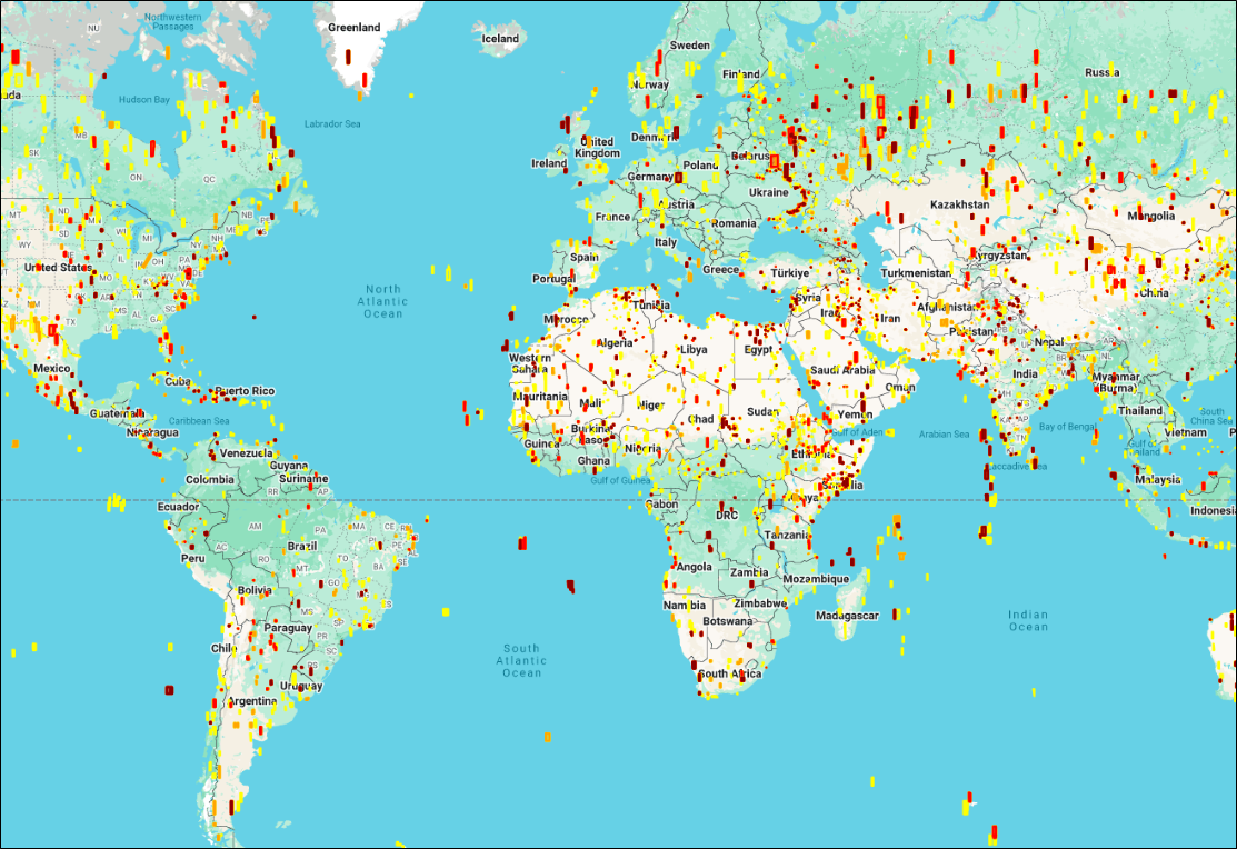
When you select a recent time frame (i.e., Last 24 Hours – Last Year), the imagery footprints are color-coded based on their age in days, as indicated by the legend in the Imagery Footprints menu. This helps you identify where the most recent imagery is located.
For example, if you select Last 7 Days, the footprints that display will be color-coded as:
-
Last 7 Days (yellow)
-
Last 72 Hours (light orange)
-
Last 48 Hours (dark orange)
-
Last 24 Hours (dark red)
Imagery footprints for the last 7 days.
-
-
To turn off imagery footprints, from the Imagery Footprints drop-down, select None.
-
To close the Imagery Footprints menu, select Imagery Footprints
 . You can close the menu at any time, even if you are still viewing footprints in the viewport.
More About Imagery Footprints
-
Your zoom level affects how footprints appear in the viewport.
-
Zoom Level 1-10.9 Footprints are outlined and filled in so you can easily find imagery in the viewport.
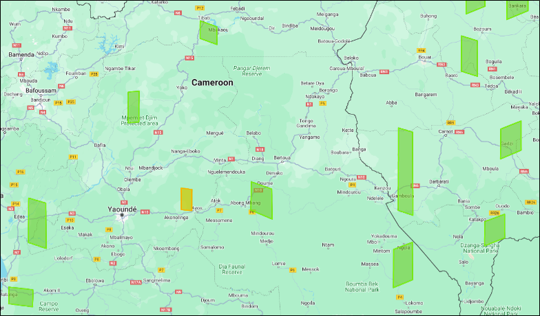
When zoomed out, you can see each footprint's outline and fill.
-
Zoom Level 11+ Imagery is visible at these zoom levels. When footprints are turned on, their colored outlines display so you can identify the time frame when the image was taken, but the fill is removed so you can see the image.
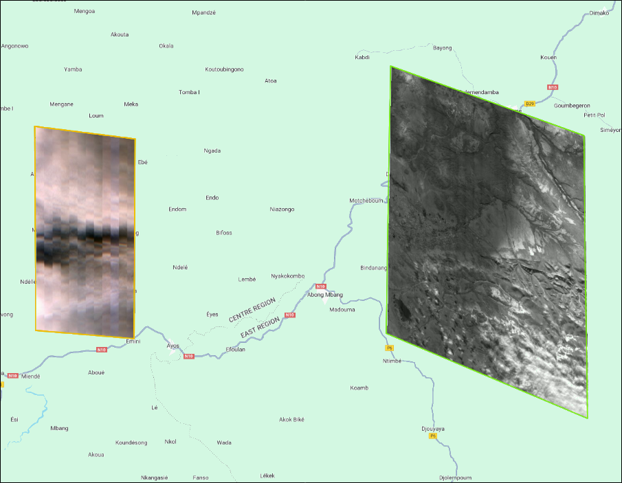
Zooming in displays the image strip while also showing the footprint's outline.
-