Working Within a Georestriction
Georestrictions limit the geographic area(s) where you have permission to view and order imagery. For example, you might be able to view imagery everywhere except over a specific restricted country. Or, you might only be able to view imagery within a specified area, such as a certain state.
Georestrictions are not applied to all accounts. If you do not have a georestriction applied to your account, you will not see the option to view georestrictions.
Viewing Georestrictions
If a georestriction is applied to your account, you can view the restricted area(s) in the viewport so you know where imagery is available to you.
Do either of the following:
-
Turn On Georestrictions Select Georestrictions
 . Georestricted areas appear in the viewport.
 -
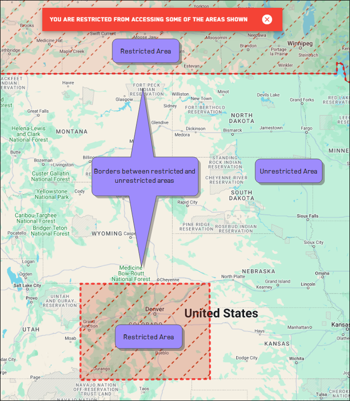
Restricted areas are indicated by red, dotted, diagonal lines. They are surrounded by a thick, red, dotted border.
-
Unrestricted areas display the basemap. At zoom level 11 and higher, available imagery displays.
-
-
Turn Off Georestrictions Select Georestrictions
 . Georestricted areas are removed from the viewport.
Turning georestrictions on and off in the interface does not add or remove georestrictions in your account. It only toggles the visual indicator of any restrictions already in place.
If an area is restricted that you think should be available to you, please contact support@vantor.com.
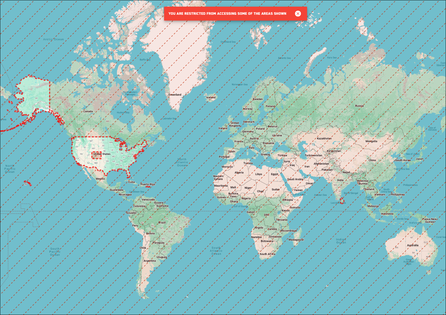
In this example, the user can only view and order imagery over the United States. The rest of the world is georestricted.
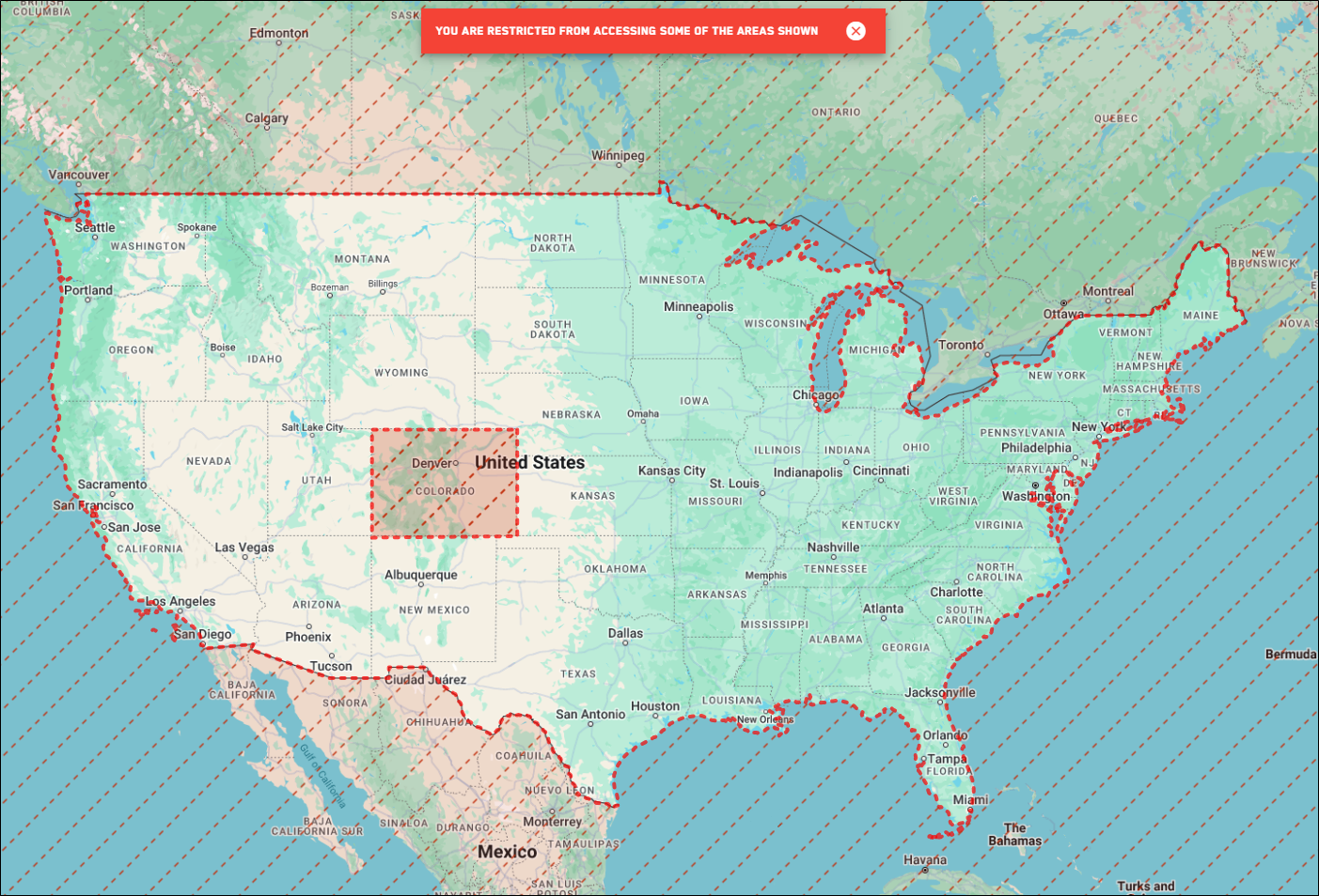
When you zoom in on the United States, you can see that an additional georestriction is in place: the user cannot view imagery over Colorado.
Viewing Imagery When a Georestriction is in Place
-
If there is a georestriction on your account, you can only view imagery in unrestricted areas.
-
If an image crosses into a restricted area, you will only see portions of the image that are over the unrestricted area. Any portion of the image over a restricted area will be unavailable.
-
If you are over a restricted area, a message alerts you that you do not have permission to access the area.
If you are over an area that is partially restricted and partially unrestricted, a message alerts you that you do not have access to some of the areas shown.