Measuring Distance
You can quickly and easily measure the distance between multiple points in the viewport.
-
 . The cursor changes to an arrow with a trailing blue dot
  to indicate that the drawing tool is active.
 -
On the map, select a starting point, then select at least one additional point. You can select multiple points to measure the distance between multiple segments.
As you draw, a callout indicates the length of each segment in miles (mi), nautical miles (nm), and meters (m).
If you draw more than one segment, additional callouts indicate the total distance between each segment, as well as the distance added by each additional segment (+mi, +nm, +m). The total distances also display in a box at the top of the viewport.
When you complete the measurement, the area between each vertex displays in the center of the "polygon."
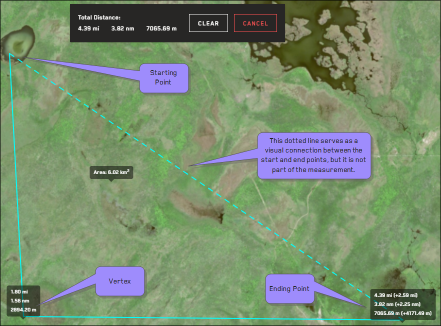
Total measurement between three points.
-
To complete the measurement, do one of the following:
-
Double-click in the viewport.
-
On your keyboard, select ESC. This uses the last-drawn vertex to complete the measurement.
The total distance in miles (mi), nautical miles (nm), and meters (m) displays at the top of the viewport. Distance is calculated to two decimal places.
-
-
(Optional) To remove the measurement, do one of the following:
-
At the top of the viewport, select Clear.
-
Select Measure Distance
 .
.
-