Using the Coordinate System
Hub's coordinate system allows you to work with coordinates in different ways. As you zoom and pan around the viewport, you can view the coordinates of your cursor's current location in the viewport. You can also select different coordinate formats, copy coordinates to quickly search for and jump to a location, and toggle the Military Grid Reference System (MGRS) grid.
Viewing Your Current Coordinates
-
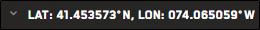
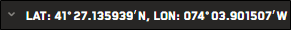
Position your cursor over the area where you want to view the coordinates. The coordinates of that location display in the

Copying Coordinates
You can copy any location's coordinates directly from the viewport. Paste coordinates in the search bar to quickly jump to that location and view imagery.
-
Right-click any location in the viewport.
-
From the context menu, select Copy Coordinates to Clipboard.
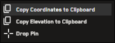
Coordinates are copied using the current coordinate system format.
The Map Pins tool supports all coordinate formats
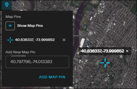
In this example, we added a new map pin using MGRS coordinates. In the viewport and the Map Pins tool, these coordinates display as a lat/long pair.
Selecting a Coordinate System
You can change the coordinate system used in Hub. The coordinate system shows your cursor's current location in the viewport.
-
At the bottom of the viewport, select the drop-down arrow
 next to the latitude and longitude coordinates.
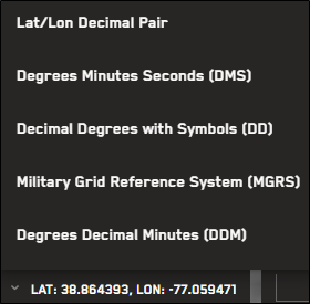
Coordinate system options
-
From the drop-down, select your preferred coordinate system. The coordinate system setting persists for the remainder of the current session, or until you change it again. New sessions revert to the default option (latitude/longitude pair).


If the MGRS grid is active, changing the coordinate system deactivates the MGRS Grid.
You can search using any supported coordinate system format. For more information and formatting examples, see Searching.
Toggling the Military Grid Reference System (MGRS) Grid Zones
You can view the Military Grid Reference System (MGRS) grid zones in the viewport. This allows you to view MGRS coordinates using a grid map overlay.
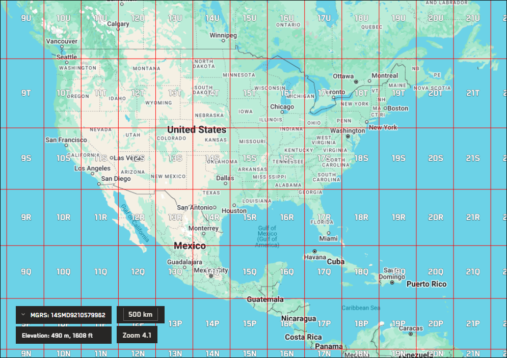
The MGRS grid zones over North America.
Do either of the following:
-
Turn MGRS Grid Select MGRS Grid
 . MGRS grid zones display in the viewport, and the current coordinate system changes to MGRS.
 -
Turn Off MGRS Grid Select MGRS Grid
 . The MGRS grid zones are removed from the viewport, and the current coordinate system changes from MGRS to latitude/longitude pair (default).